
Run the city as one living system.
A 3D digital twin, a city-wide IoT sensor network, and AI that detects and resolves infrastructure issues — before citizens ever notice.
Built for the people who run the city.
Operational gains that translate directly into faster decisions and safer, more efficient services.
Security & Independence
Full control and data security through on-premises hosting. Every byte stays on local municipal servers.
Rapid Decision Making
Instant, accurate management calls backed by real-time data and AI-powered recommendations.
Comparative Analysis
Inter-city performance comparison and identification of best practices across regions.
Inter-institutional Integration
Municipality, police, fire department, and other institutions coordinated on a single platform.
The city app, screen by screen.
Swipe through every screen of the Clavus mobile experience — navigation, live data, and citizen services.
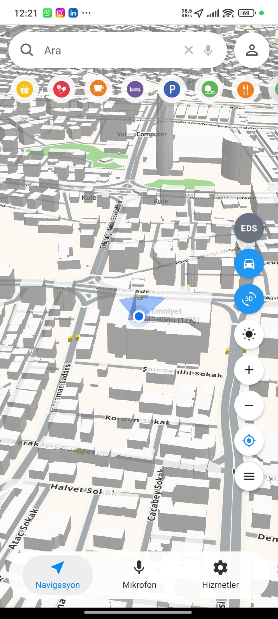
Interactive 3D Map
Explore the city on a fully navigable 3D digital twin.
- LOD1.2 city modeling
- 3D / 2D view toggle
- Place search & POI shortcuts
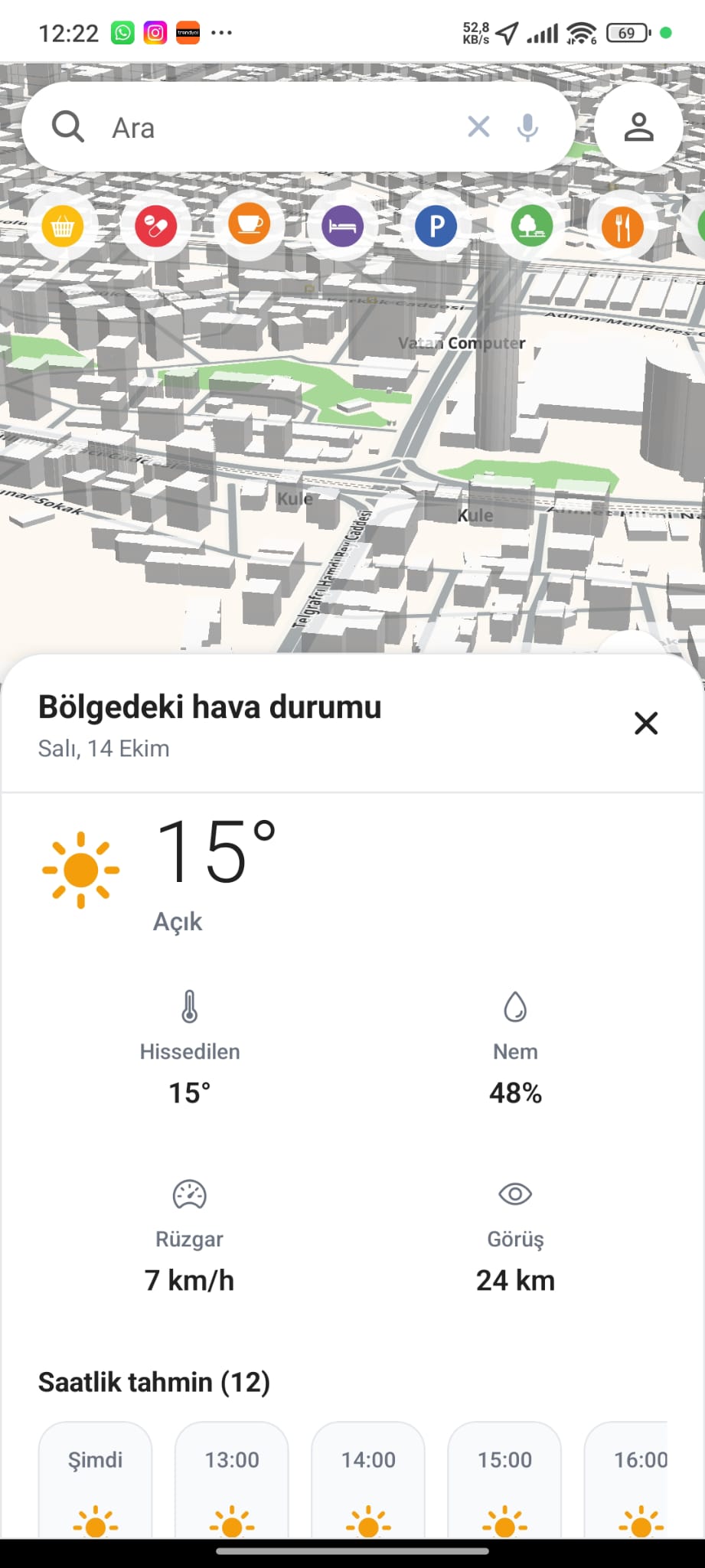
Live Weather
Real-time local weather right on the map.
- Feels-like & humidity
- Wind & visibility
- 12-hour forecast
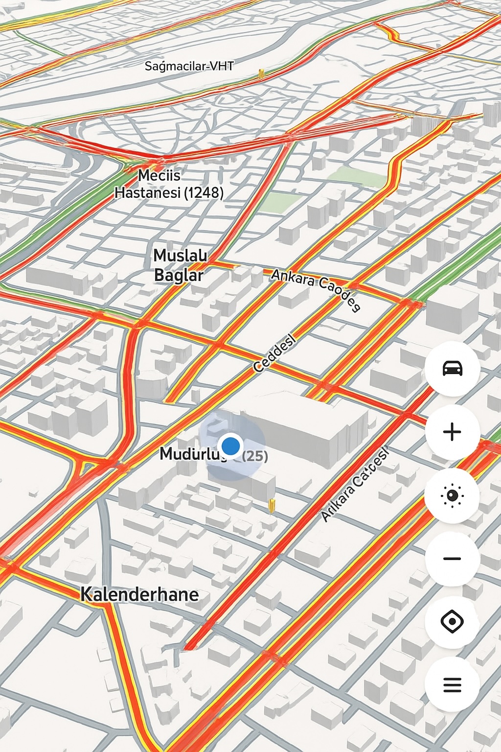
Real-Time Traffic
Live traffic density across the whole city, colour-coded and updated continuously.
- Live congestion overlay
- Street-level density
- Continuous updates
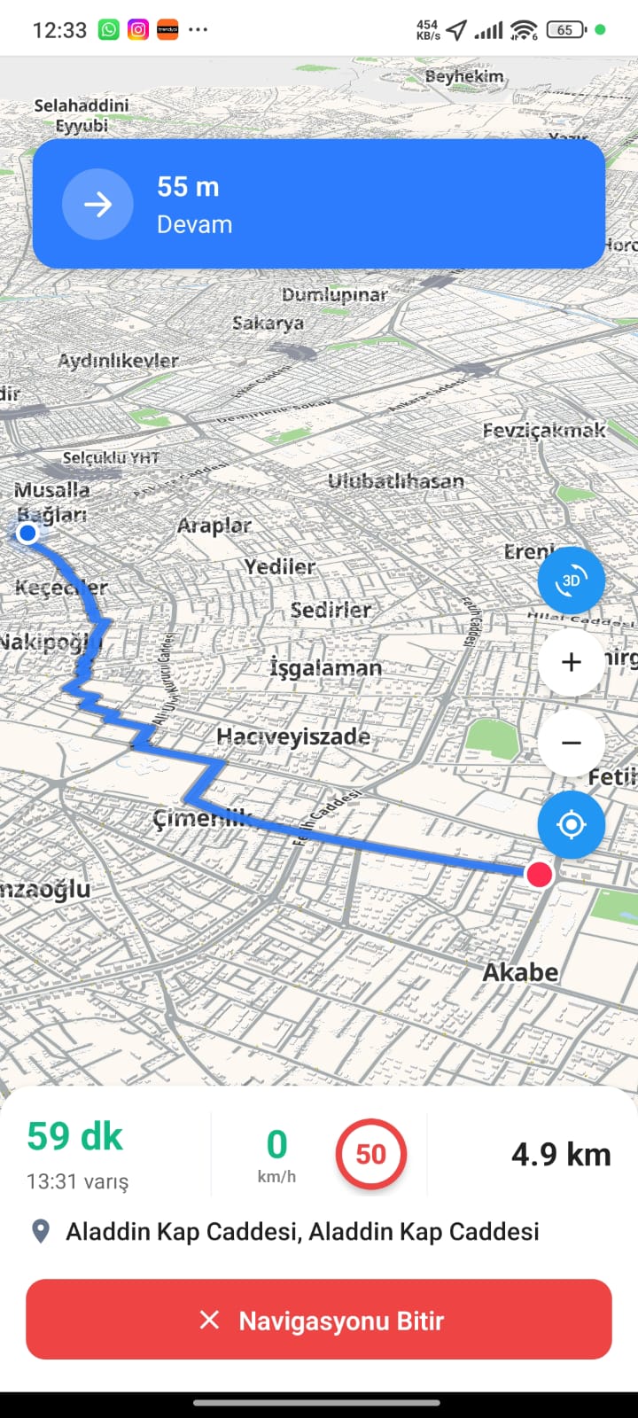
Turn-by-Turn Navigation
Active guided navigation with clear next-move prompts, live ETA and current speed.
- Step-by-step prompts
- Live ETA & distance
- Speed-limit awareness
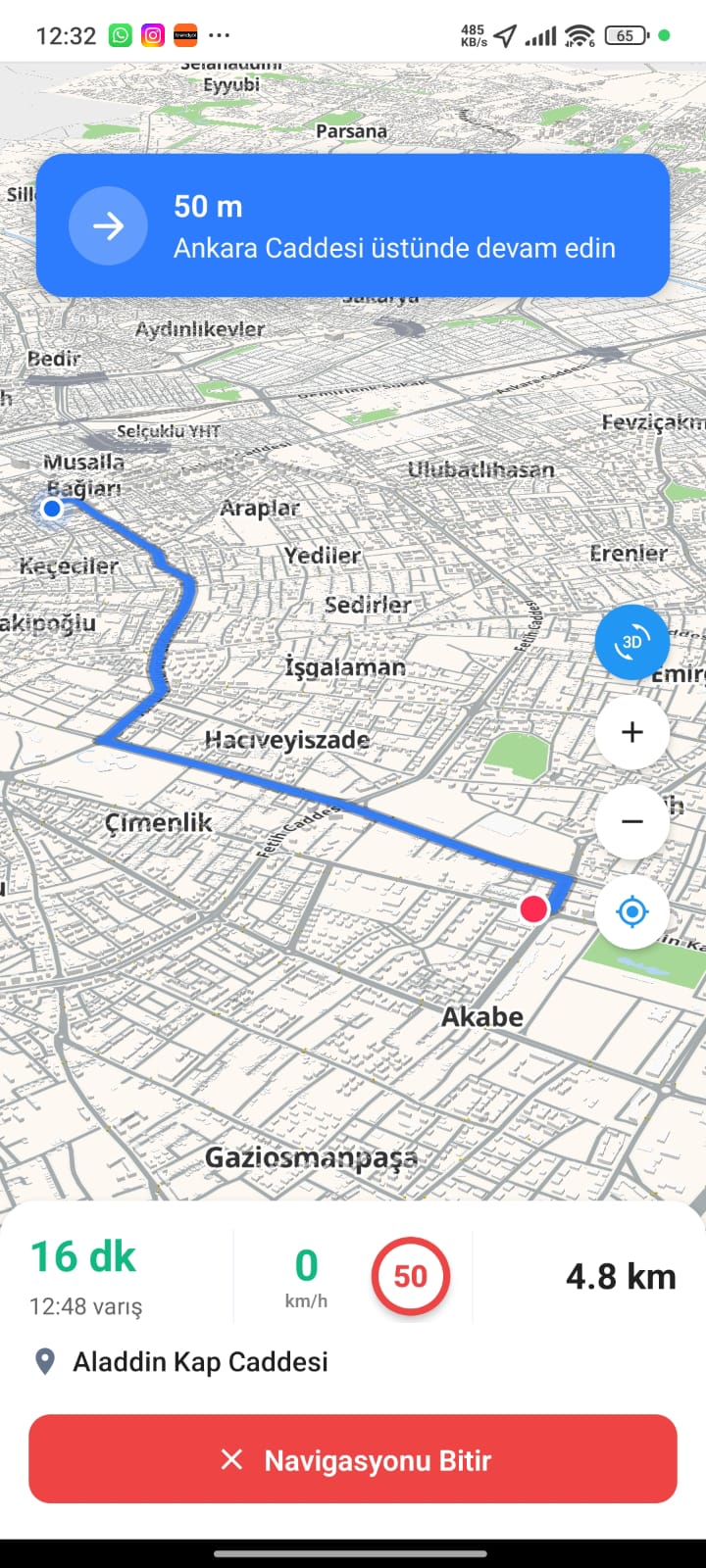
Guided Routing
Stay on course with continuous street-by-street instructions and a live route line.
- Active route line
- Street-by-street cues
- Dynamic re-routing
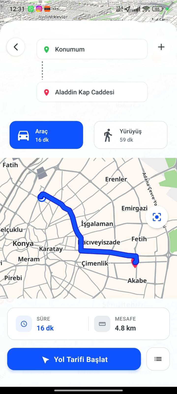
Route Planning
Plan any trip and compare driving and walking options before you set off.
- Car vs walking compare
- Duration & distance
- One-tap start
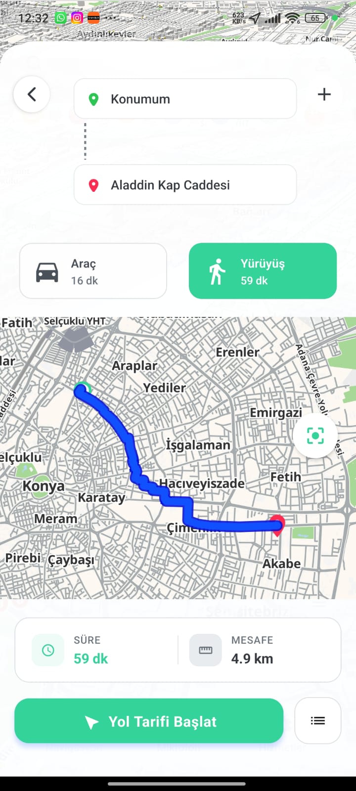
Walking Routes
Pedestrian-friendly routing with optimized path, duration and distance.
- Pedestrian path
- Walking duration
- Foot-traffic friendly
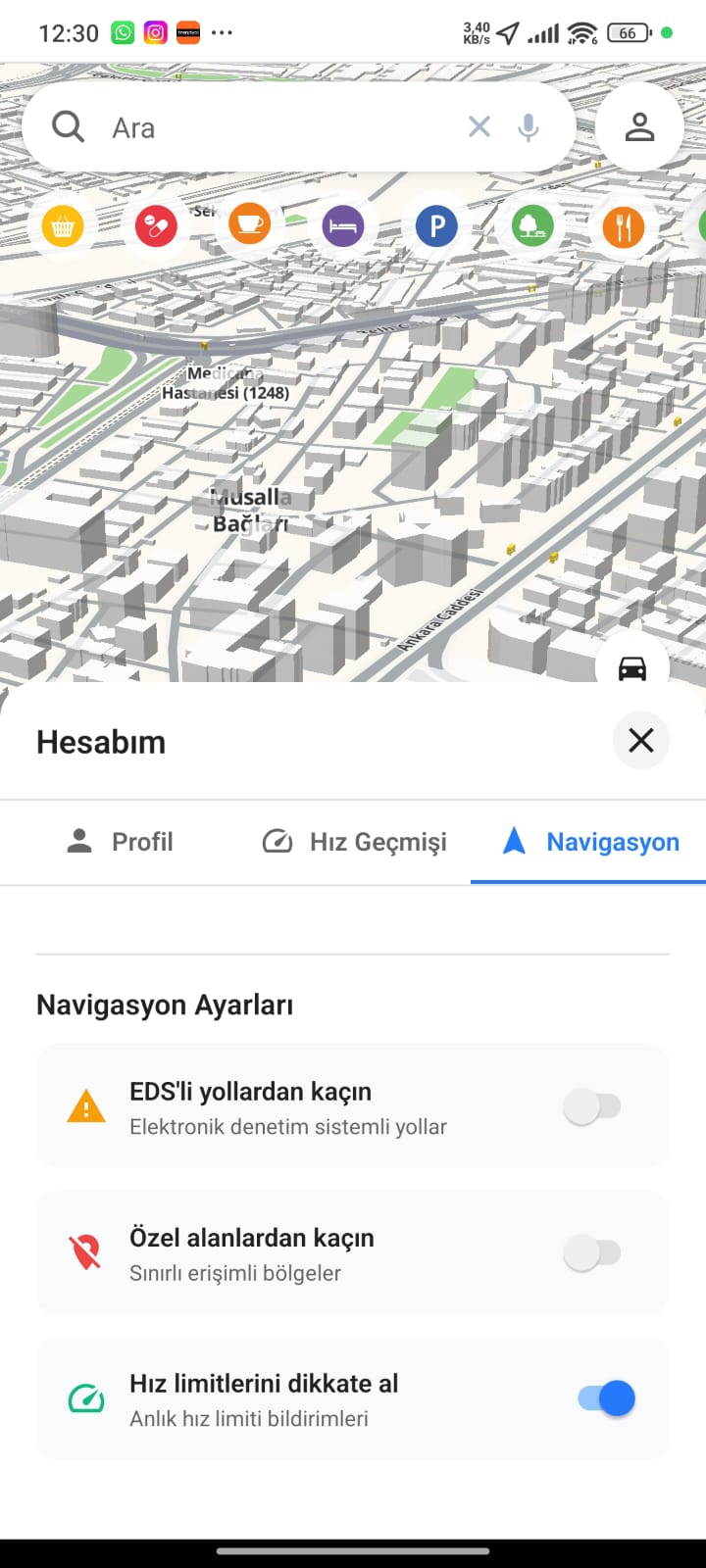
Navigation Settings
Tailor how you are routed — avoid EDS roads, skip restricted zones and keep speed-limit alerts on.
- Avoid EDS roads
- Avoid restricted areas
- Speed-limit alerts
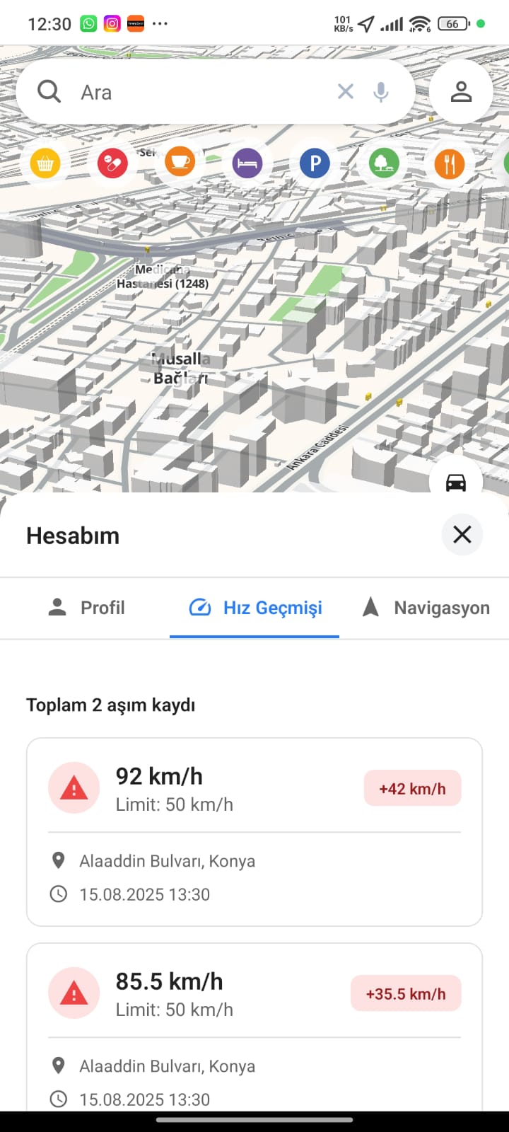
Speed History
A personal log of speed-limit overages with location, recorded speed and timestamp.
- Overage records
- Location & timestamp
- Limit vs actual speed
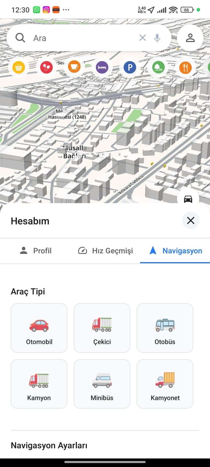
Vehicle Profiles
Pick your vehicle type so routing respects its size and limits.
- Six vehicle types
- Profile-aware routing
- Restriction handling
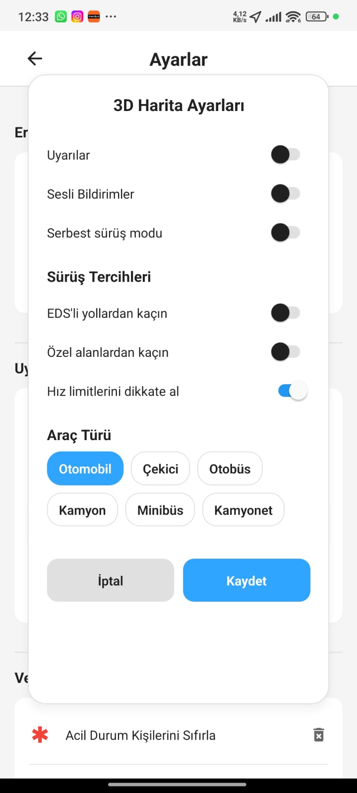
Map Preferences
Fine-tune the 3D map experience with alerts, voice notifications and driving preferences.
- Voice notifications
- Free-drive mode
- Driving preferences
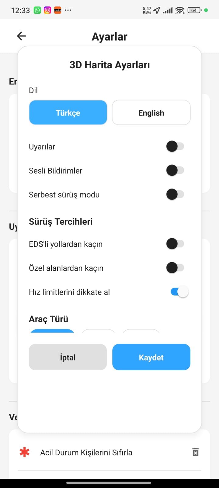
Language & Options
Switch the interface language and adjust every map setting from a single panel.
- Multi-language support
- Unified settings panel
- Instant apply
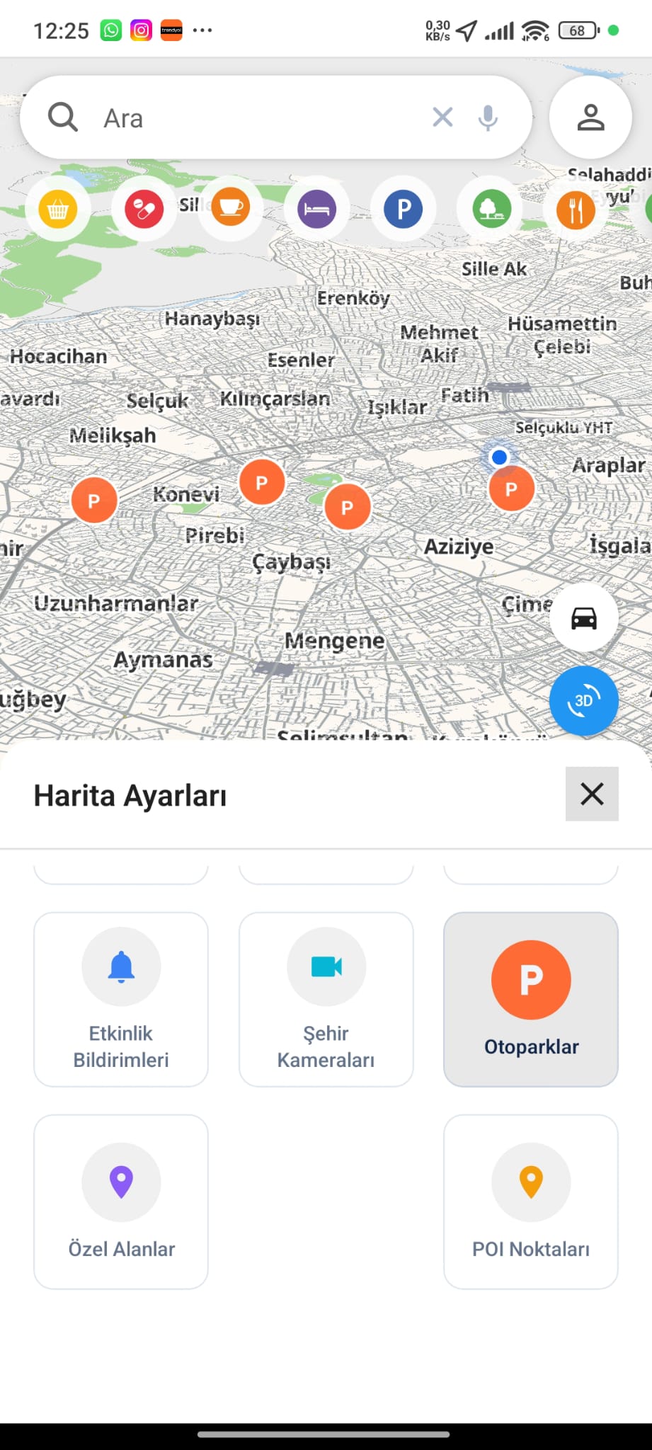
Parking Layer
See available car parks across the city as live map markers.
- Live parking markers
- Nearest-lot view
- Map-based discovery
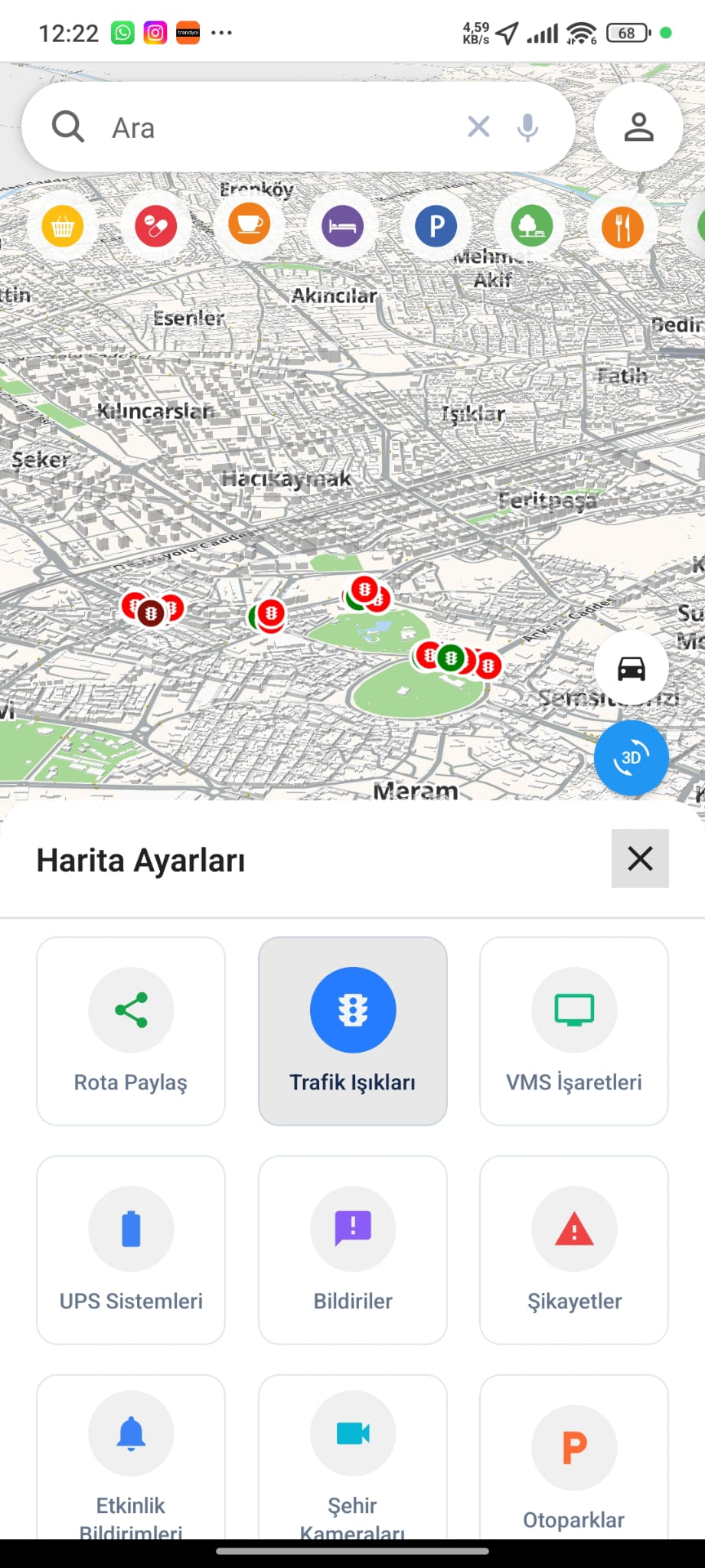
Traffic Lights Layer
Overlay live traffic-signal locations and status to understand intersection flow.
- Signal locations
- Intersection status
- Network-wide view
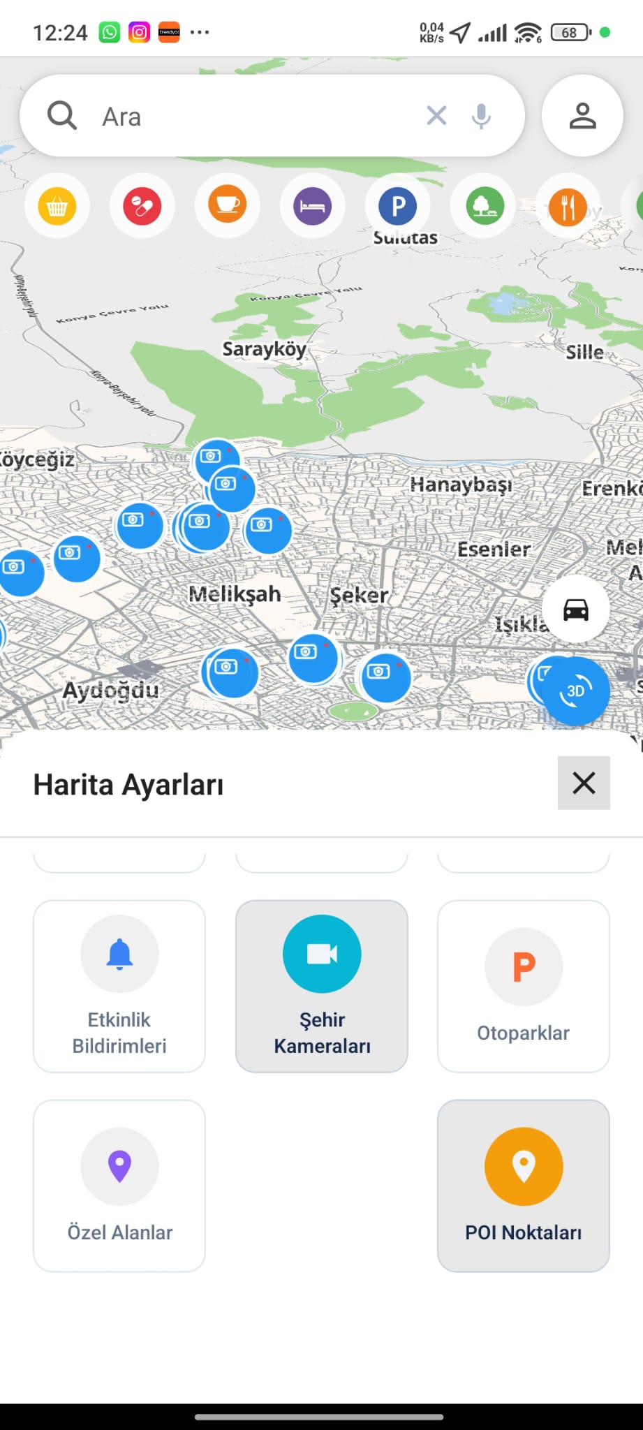
City Cameras Layer
Bring thousands of city cameras onto the map for instant visual context.
- Camera markers
- Visual context
- City-wide coverage
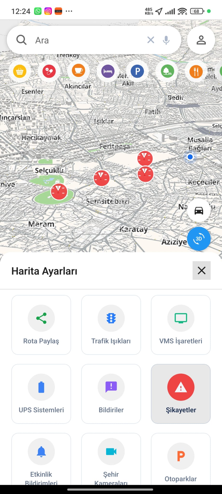
Citizen Complaints
View reported issues as map markers, supporting transparent city management.
- Reported-issue markers
- Category context
- Participatory feedback
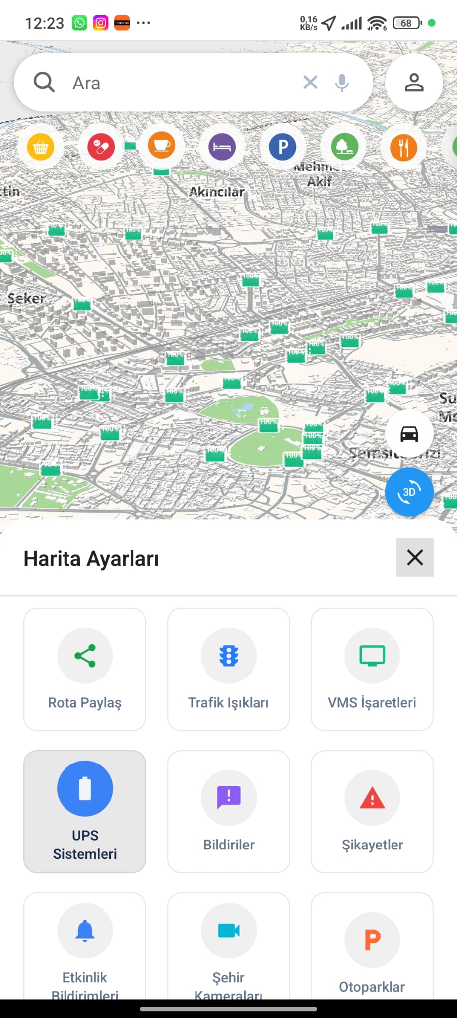
Power Infrastructure
Monitor UPS and power-supply points across the city as a dedicated infrastructure layer.
- UPS point markers
- Infrastructure layer
- Reliability monitoring
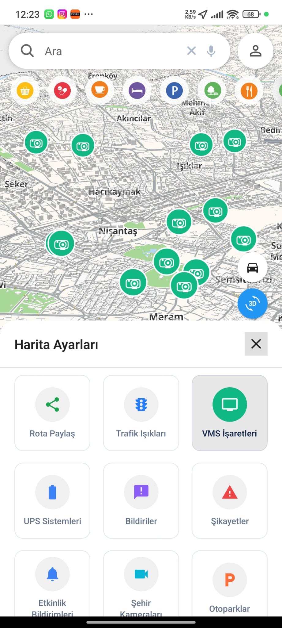
VMS Signs Layer
Show variable-message sign locations to follow live road messaging across the city.
- VMS sign markers
- Live road messaging
- Driver guidance
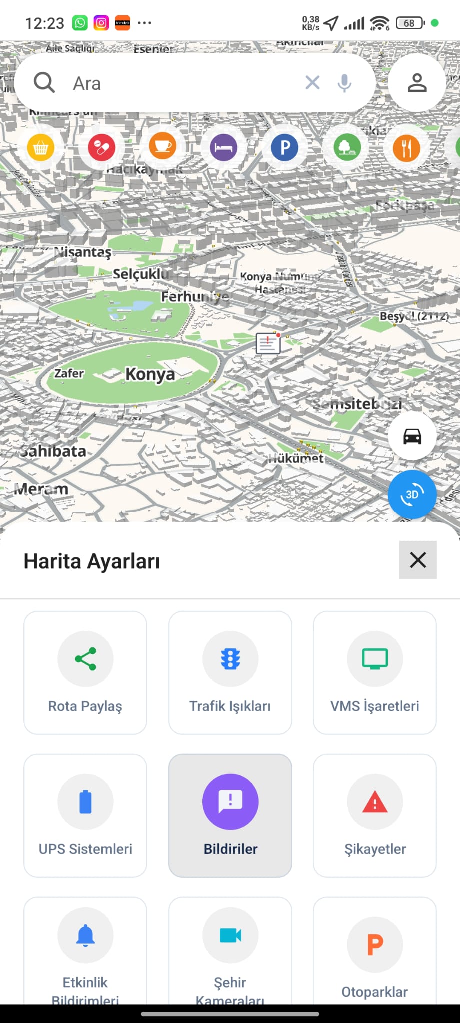
Bulletins Layer
Surface official announcements directly on the map exactly where they apply.
- Official notices
- Location-pinned
- Timely updates
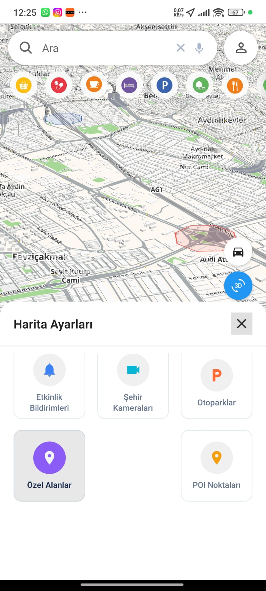
Restricted Areas
Highlight special and restricted zones on the map so routes respect access limits.
- Zone highlighting
- Access limits
- Route-aware
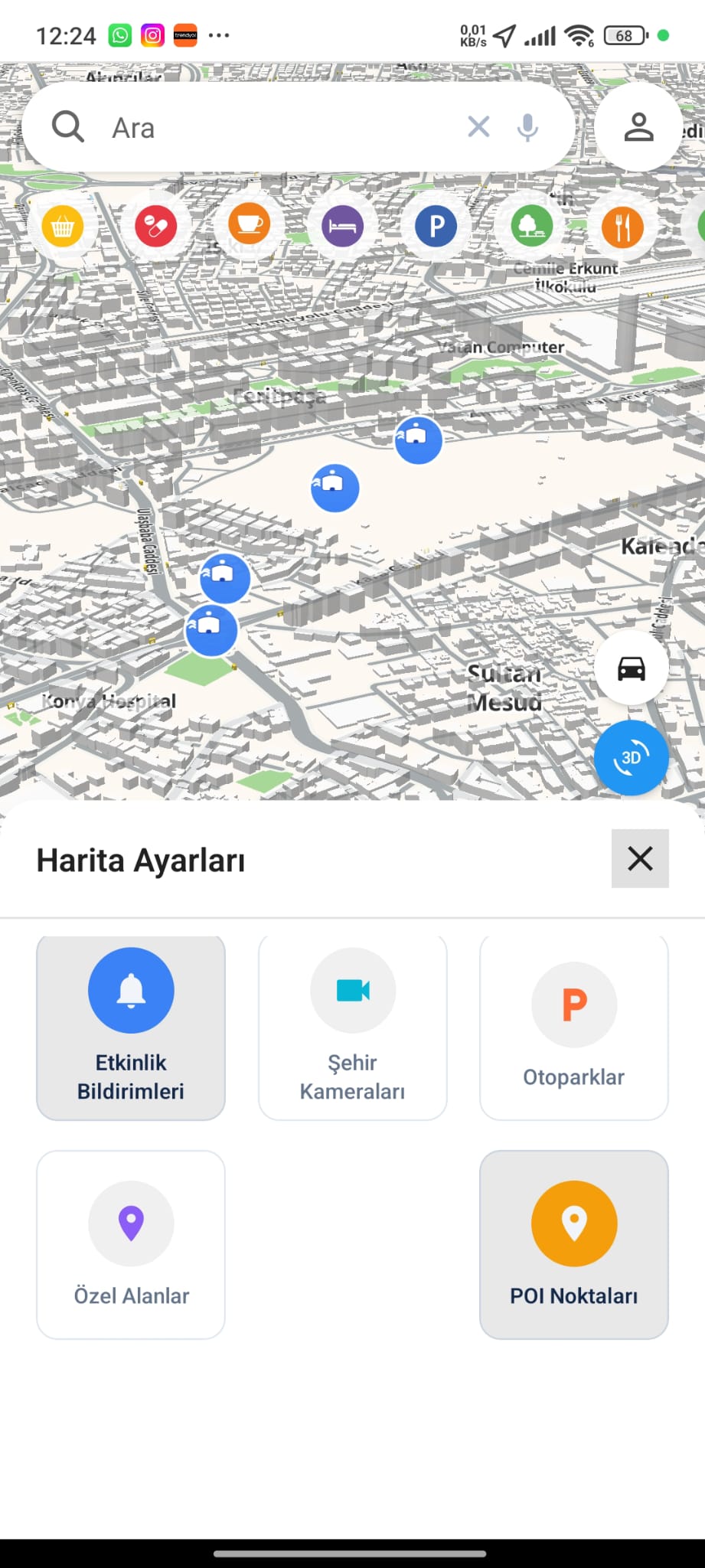
Event Notifications
Pin live event alerts to the map to stay aware of what is happening around the city.
- Event markers
- Live alerts
- Around-you awareness
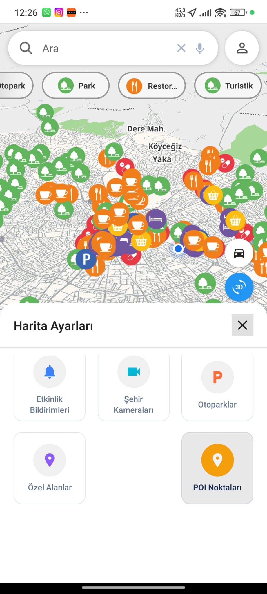
POI Discovery
Explore points of interest by category — parks, restaurants, cafés and more.
- Category filters
- Rich POI markers
- Map-based browse
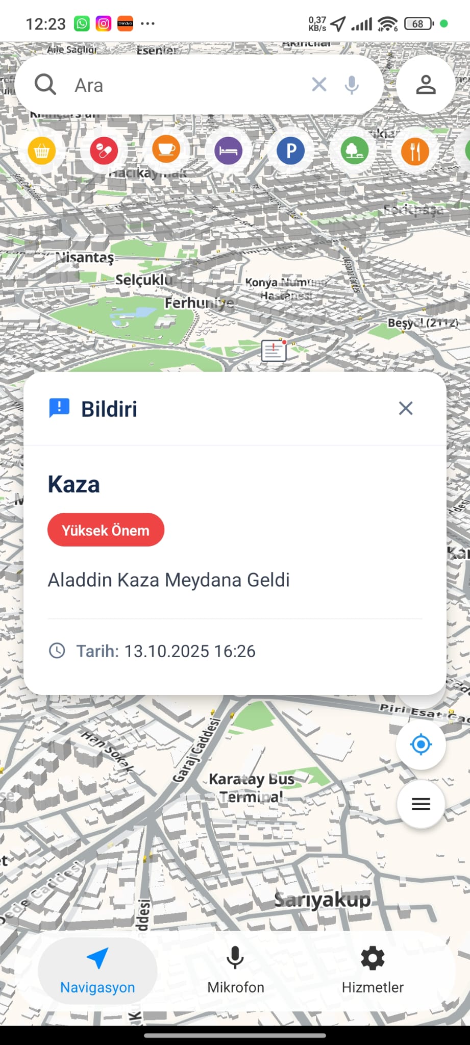
Incident Alerts
Instant high-priority incident notices with severity and time, pushed as they happen.
- High-priority alerts
- Severity & timestamp
- Real-time push
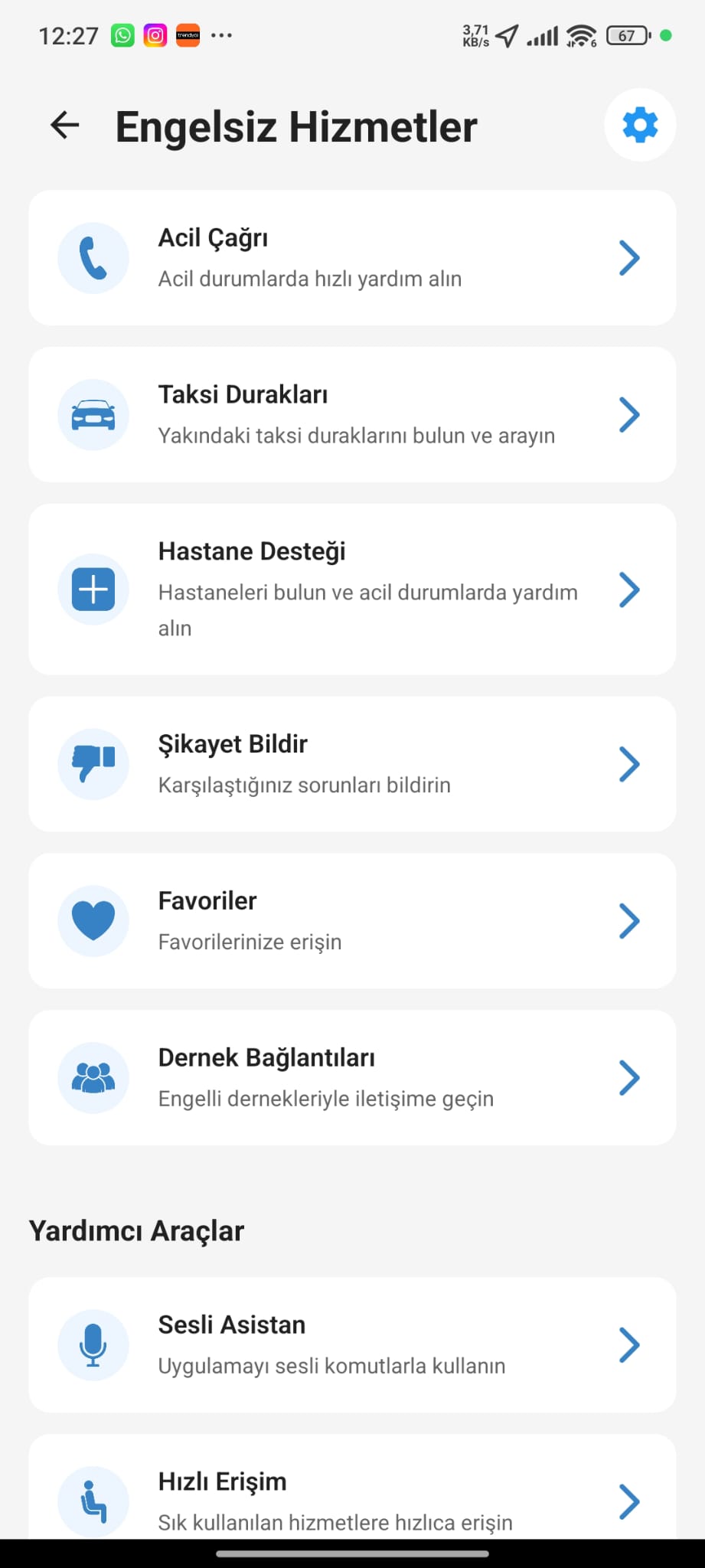
Accessible Services
A dedicated hub for emergency calls, taxi ranks, hospital support, complaints and accessibility tools.
- Emergency & taxi access
- Hospital support
- Voice assistant
One platform, every layer of the city.
Six core systems built on a shared digital twin — select a module to see what it does.
3D Digital Twin Map
An advanced GIS engine that transfers the entire physical structure of the city into a three-dimensional digital environment with LOD1.2 modeling.
- Layered map structure
- Semantic data modeling
- Area & distance calculation
- Disaster simulations
- Zoning status visualization
Engineered on a modern, sovereign stack.
From LiDAR scanning to edge computing — the building blocks that keep the platform fast, private, and resilient.
API Integration
RESTful architecture
Artificial Intelligence
Predictive analysis
Big Data
Real-time processing
Cloud Architecture
Scalable & secure
Computer Vision
Scene understanding
Edge Computing
Local processing power
LiDAR Scanning
3D city modeling
Drone Integration
Aerial monitoring
Cybersecurity
End-to-end encryption
Cross-Platform
Web · iOS · Android
Spatial Intelligence
Geo-aware reasoning
Autonomous Systems
Self-healing ops
Build smart, sustainable, livable cities.
Bring your infrastructure, traffic, environment, and citizens into one living digital twin.